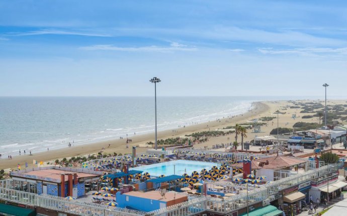
Las Arenas Gran Canaria
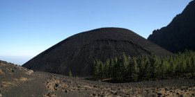
 During the "holiday season" of the years 1704 and 1705 three volcanoes erupted in the south-east of the island of Tenerife on the Canarian Islands. A fissure had opened and along its line the three new volcanoes were located: Montaña Siete Fuentes near Arico in the south, Montaña Fasnia near the likewise called village and Montaña de las Arenas high above the town of Arafo in the narrow canyon of Barranco de las Gambuesas. The first two are minor mountains of roughly 400m - 600m elevation while Montaña de las Arenas reaches 1577m. However, it is still dwarfed by the neighbouring walls of the canyon, Las Morras to the east and Pico del Valle to the west. Still the mountain is a very good example of a rather recently created volcanic cone and one the ascent of which amounts to a rather big struggle.
The trailhead to the mountain is located in the town centre of Arafo, some five km to the south and 1100m of elevation beneath Montaña de las Arenas. The ascent route follows Camino de la Candelaria, an old pilgrimage trail, which connects the north coast of the island with its south coast across the impressive risge of the Cumbre Dorsal, Tenerife's second highest mountain range, of which Montaña de las Arenas is a part. The pilgrimage trail has been worn out by millions of pilgrims, especially on the northern side of the Cumbre. It runs through beautiful forests of huge Canarian Pines but for two small stretches. One near the top, close to the Cumbre Dorsal ridge, one in the south at an elevation of 1400m - 1600m. Exactly where you find Montaña de las Arenas...
The trail passes the mountain on its western side and while there are several possible routes the easiest is the one shich starts from the upper part of the barranco in the north-west. It avoids a collapsed cavern to the left and steeply scamble up the cinder slopes in several switchbacks. The scree is horribly loose making the last 100m the major effort of the whole climb. Descending however is fun...
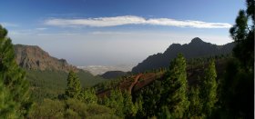
While in most other areas of the island the volcanic devastation has been grown over by pioneer plants, here you encounter a veritable moonscape. A handful of chestnut trees grow on the southern slopes of the mountain but in winter they look like ghosts. The views are splendid - given that there are neither mist or haze. Barranco de las Gambuesas look directly towards the island of Gran Canaria, which appears to hover above the south coast of Tenerife.
Getting There
View through Barranco de las Gambuesas towards Montaña de las Arenas and the south coast
As one of the major European vacation getaways Tenerife can be reached from all major European airports. From Spain there are regular flights from the rest of Europe you can book lots of charter flights. On Tenerife there are two international airports, one at Santa Cruz in the east, one at Los Abrigos in the south.
The easiest approach to Montaña de las Arenas is from the Crucita saddle high up on the Cumbre Dorsal Ridge. There is a small parking lot with a mirador from which a path leads down into Barranco de las Gambuesas and thus towards Montaña de las Arenas. It is a 600m descent, which will have to be climbed back out again on returning from the mountain.
The real trailhead, however is right in the centre of the town of Arafo. Since it is very low (438m) you might drive up to the upper outskirts of the town. There are no real parking lots but for the town centre so let's assume the climb starts there.
 Take motorway TF1 to the exit Arafo. Turn onto TF281, direction La Hidalga and Arafo. A left - right combination takes you onto TF245 to Arafo. In the town look for the town centre near the church. There is a parking lot near a small kiosk.
Red Tape
Montaña de las Arenas is part of the natural park "Parque Natural de Corona Forrestal". Quite naturally all usual restrictions for natural parks apply. In spring the ridge of the Cumbre Dorsal Range is studded with lots of flowers (mainly gorse bushes but also others). There are a lot of bees and bumble bees around, which can be very aggressive. Just leave them alone and pay lots of attention!Accommodation
Of course you can find a lot of hotels, fincas and casas on the island which you can book from any travel office. The nearest towns are Güimar and Arafo in the south. Both offer limited accommodation possibilities so it is advisable to stay at one of the resort towns and villages further down the slopes near the coast.Weather Conditions
There are several sites on the web which give you information on the weather on Tenerife. However, they all show the weather for the coastal regions (Puerto de la Cruz) which significantly differs from the weather in the Cañadas del Teide or the Cumbre Dorsal which are 2000m of elevation higher. The following table shows data for Puerto de la Cruz on the coast.| Month | Jan | Feb | Mar | Apr | May | Jun | Jul | Aug | Sep | Oct | Nov | Dec |
| Avg. day temp.[°C / °F] | 19 / 66 | 20 / 68 | 21 / 70 | 22 / 72 | 23 / 73 | 24 / 75 | 26 / 79 | |||||
| Avg. night temp.[°C / °F] | 13 / 55 | 14 / 57 | 16 / 61 | 18 / 64 | 17 / 63 | |||||||
| Water temp.[°C / °F] | ||||||||||||
| Rainy days | 10 |
The Canarian Islands (as well as Madeira) are located in the trade wind zone. You almost always encounter northeastern winds which carry a lot of humid air. Being forced to climb to higher altitudes this moisture condenses into clouds. This in return means that most of the time the northeastern part of the islands is covered in clouds from altitudes of 1000m through 2000m.
The mountains themselves - being mostly of the same altitude - finally stop the clouds so that on their southeastern slopes the clouds "run out". In the case of Tenerife the Cumbre Dorsal is about the elevation the clouds reach so that you might be disappointed with respect to views. Moreover, the range is almost always swept by very fierce winds!
Thanks to its location in Barranco de las Gambuesas, Montaña de las Arenas is relatively weather proof. The Cumbre Dorsal Range stops all clouds and within the barranco you can be sure to have good weather. So good indeed that you should think of bringing sun protection and lots of water.
